| data | ||
| media | ||
| src | ||
| .gitignore | ||
| Dockerfile | ||
| LICENSE | ||
| README.md | ||
| requirements.txt | ||
Geo3DP
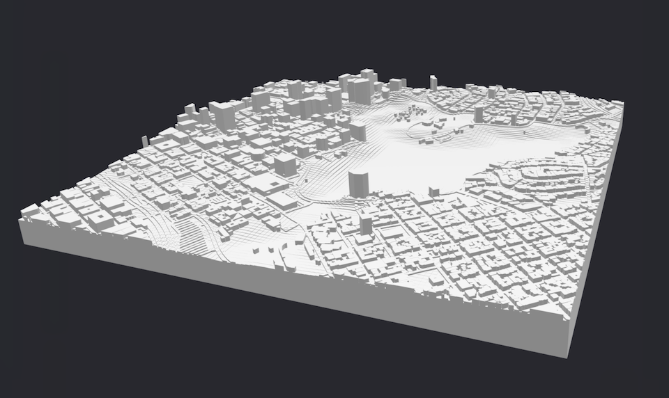
Open model generator for 3D printable geography based on OpenStreetMap.
Downloading GIS Data
Geo3DP requires 2 types of data files as input:
- OpenStreetMap data as a .osm.pbf file. Available via OSM by the Slice.
- Elevation data as a GeoTiff file. Available from the SRTM GL1 dataset via OpenTopography.
Usage
The included Dockerfile takes care of installing dependencies. To run with Docker, (using the ./data folder for input and output files):
docker build -t geo3dp:latest ./
docker run --rm -it -v "$(pwd)/data:/app/data" geo3dp:latest \
    --osm "/app/data/<name of .osm.pbf file>" \
    --topo "/app/data/<name of .tif file>" \
    --bbox="<min. longitude>,<min. latitude>,<max. longitude>,<max. latitude>" \
    --edge-len "<length of long edge of model, typically in mm>" \
    --output "/app/data/output.stl"
- Latitudes and longitudes are encoded as decimals. That is, values south of the equator or west of the prime meridian are expressed as negative numbers.
- Note the "=" and quotes on the
--bboxargument so that negative numbers are not parsed as separate CLI arguments.
Other available options include:
--square: crops the model area to a square centered within the bounding box--baseplate-h: adjusts the height of the rectangular base--water-cutouts: creates through holes where there are water features
Parallel Rendering
To improve performance, Geo3DP automatically splits the model area into multiple
tiles to parallelize rendering across available CPU cores. In general, the more
CPU cores available to the Docker engine, the faster a model will render. The
number of tiles per side can be adjusted manually with the --slices option.
Refer to --help for more details.
Known Issues
Combining Rendered Meshes
Due to limitations of the OpenSCAD STL exporter/importer, Geo3DP does not
perform a proper union calculation of the resulting tiled geometry, but rather
combines the tiled meshes by aligning them side-by-side. This results in a final
STL file with a nonsensical internal geometry, but 3D printing slicers don't
seem to mind. This issue may be at least partially addressed by running with
--slices=1 to turn off tiling.
Topography Smoothing
Geo3DP applies simplistic smoothing to the computed elevation map to mitigate artifacts in the GeoTiff data. The smoothing algorithm works well in most cases, but could be improved to better handle smoothing at the edges of the model and consistency across varying map resolutions.